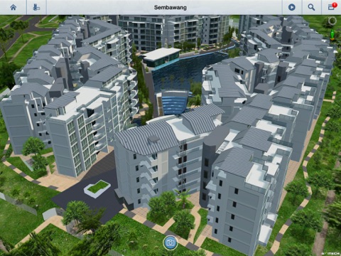
URA 3D Urban Explorer
3D city-level model data viewer for mobile devices released by Gvitech Corporation.
Key Features
-Support city level fine 3D model data loading and navigation.
-Excellent rendering effect.
-Fast loading and navigation speed.
-Load 3D tile data service from server.
Functions
-3D Area List
List all the area, allow users to switch between different areas.
-Bookmark
Allow users to view the pre-set bookmarks.
-Route
Allow users to view the pre-set routes.
-Search based on OneMap service interface
Allow users to do search based on OneMap service interface.
-Pedestrian Mode
View the 3D scene simulating pedestrian walking in the area.
-Measurement
Provide multiple measurement tools,such as distance measurement,area measurement,coordinate measurement.


